Tuesday, May 26, 2020

Blake Wood's Circumnavigation of the Valles Caldera in One Day!

Blake Wood recently did an amazing 25 hour, 67 mile run around the whole Valles Caldera that he documented in his Facebook Album, "Caldera Circumnavigation"! The map of his run below clearly shows how he closely followed the Valles Caldera Rim with the exception of a portion of the north rim which was run at night. He began at 6 am on Friday, May 8, from the Pajarito Mountain Ski Area and finished back at the ski hill the next morning. His wife, Rebecca, was his support team and even did the final mile with him back to the ski hill! With Blake Wood's permission (thank you!), the main narrative and the map from his May 10, 2020 Facebook post of his album, "Caldera Circumnavigation" are shown below.

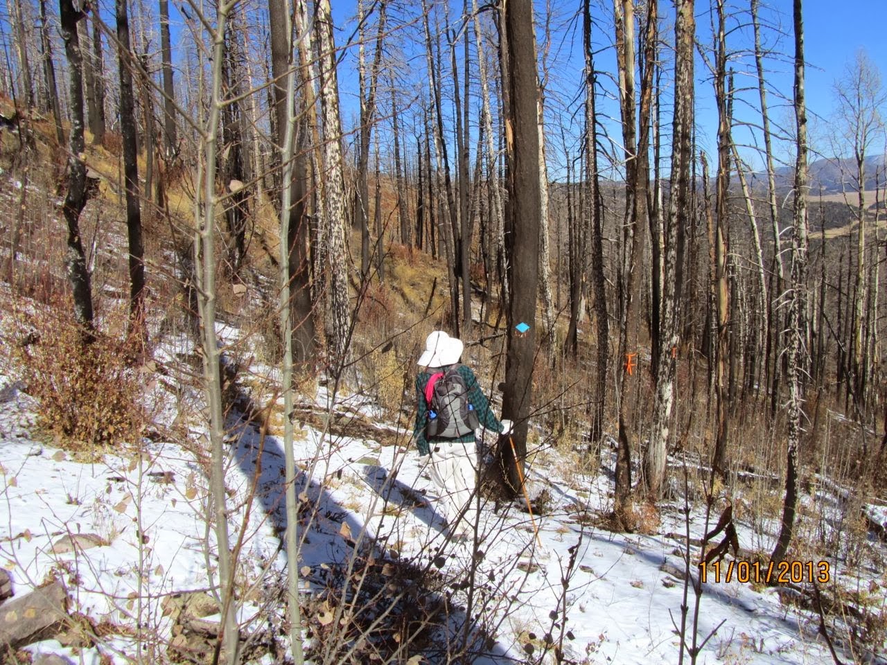
The full post has 21 photos, with descriptions, which can be viewed either on his personal Facebook page as a public post or as a share on Valles Caldera Rim Trail, a public Facebook page, or on the private Facebook group, Los Alamos Trails. To really appreciate Blake's accomplishment, you have to see the photos! They are stunningly beautiful, sometimes starkly so in the areas torched by the 2011 Las Conchas wildfire. The photos depict the challenging trail conditions in the burnt areas of the caldera rim. Blake's run is a bold tribute to Dorothy Hoard's long-deferred dream of a Valles Caldera Rim Trail. Thank you, Blake (and Rebecca!) for doing the run! This is inspirational for anyone who has heard of the "fabled" Valles Caldera Rim Trail. Even if we cannot run around the caldera rim in one daring day of ground truth, like Blake, an amazingly talented athlete, there are some sections of the caldera rim that many of us could enjoy right now. Blake's post and Dorothy Hoard's maps and research will inspire you to begin:

Since all my races were cancelled this spring, I needed an adventure. So Friday I ran around the entire Valles Caldera. This was 67 miles and took me 25 hours, starting from the Pajarito Mountain Ski Area and going in the clockwise direction. For those of you reading this who don't live in Northern New Mexico, the Valles Caldera is a circular volcanic caldera roughly 15 miles in diameter. The Valles Caldera National Preserve (VCNP) is administered by the National Park Service, and was acquired by the federal government from private ranching interests in 2000. The floor of the caldera is at about 8000' elevation, and much of the rim is over 10000' elevation.
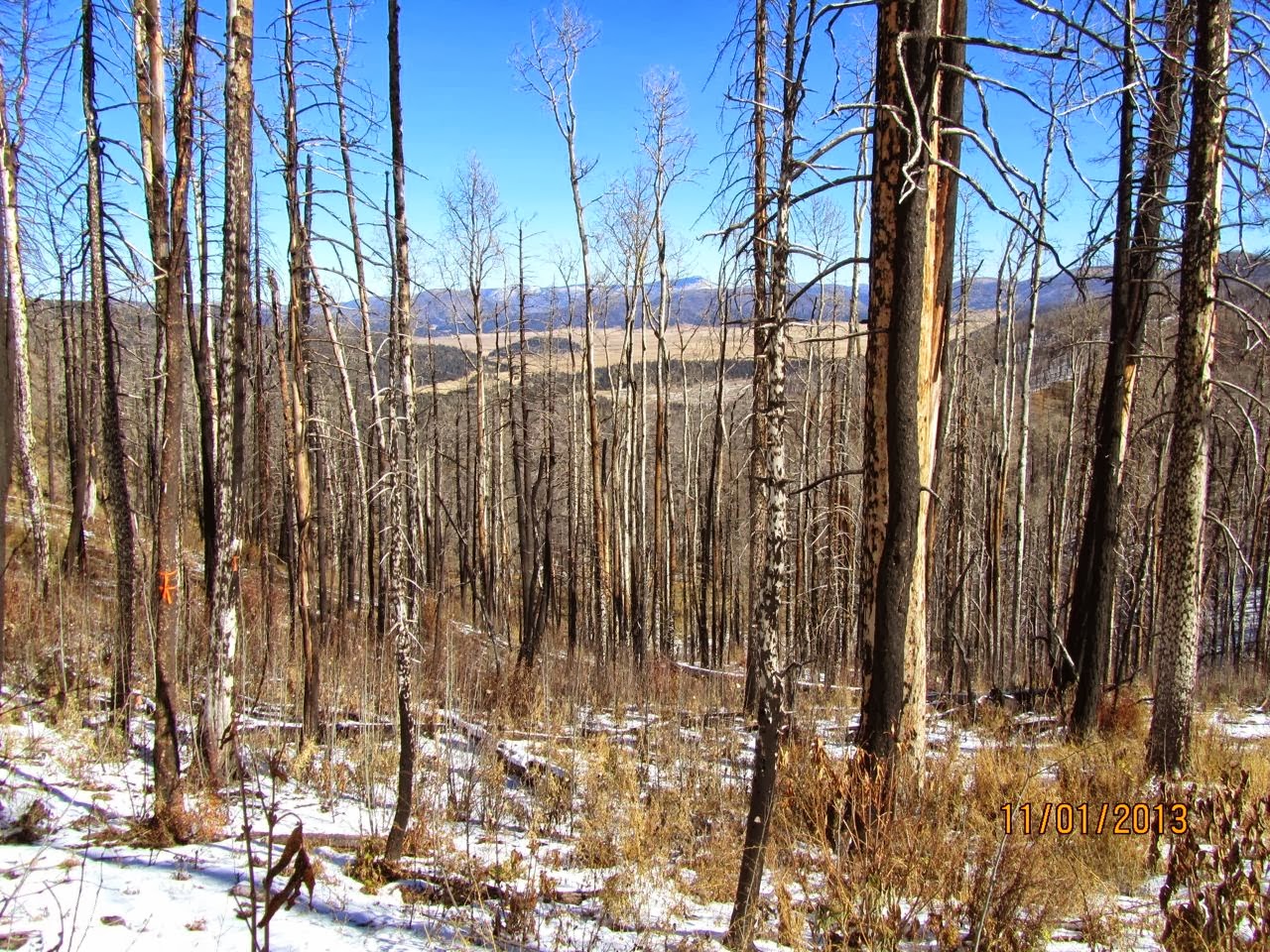
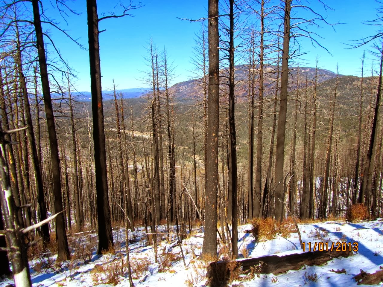
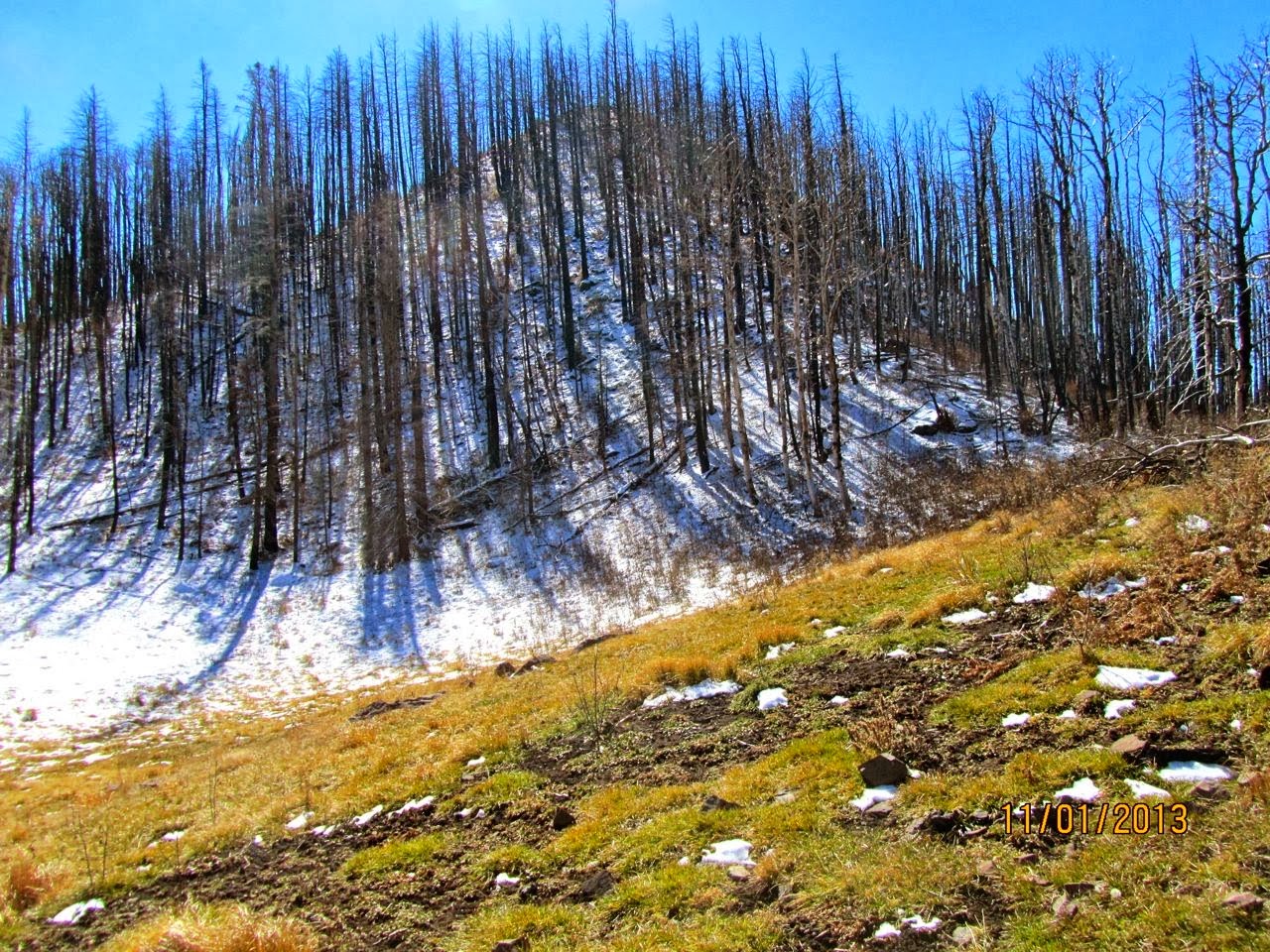
I've been intrigued with running this since reading Dorothy Hoard's various 2009 proposals for a rim trail around the VCNP (http://vallescalderarimtrail.blogspot.com/). Since then, the 158,000 acre Las Conchas Fire happened in 2011, burning the rim from about the 12:30 position to the 6:30 position, and wiping out many of the trails and dirt roads that would have constituted such a route. Ironically, in her report Dorothy Hoard frequently commented that the heavy forest cover obscured views of the caldera. That isn't a problem any more! But the area is not a wasteland - in the years since much of the burned area has filled in with aspen. It does make travel difficult, however, as many of the previously runnable trails and roads are now covered with fallen trees and thorn bushes.
I started at 6 am. My wife, Rebecca, met me in five locations over the first 12 hours with food, water, and gear. I created a pacing spreadsheet for my anticipated route, assuming various paces between 1-5 mph depending on the terrain, and hit my times to meet Rebecca within a few minutes. I tried to drink 1 quart/hour of water and consume 200-300 calories/hour, which seems to be sufficient for me to run all day. I stashed water in a couple locations for the night, but the one gallon I took with me from my 8:30 pm drop lasted me to the end. I made one navigational error in the dark before the moon rose which scuppered my plan to run over Cerro de la Garita on the north rim. I think this would have added 3 hours to the alternate route I followed along the floor of the Caldera. It got cold enough during the night that the grass was crunchy with frost, but mercifully the strong winds we've been having recently were relatively mild during the dark hours on the ridges.
This is a beautiful route, even in the burned areas! Off the roads, I never saw another person. My daughter was worried that I'd be eaten by bears or mountain lions while alone during the night, but all I saw were elk, grouse, and turkeys, and I was serenaded by a nearby pack of coyotes during the night. A far greater danger was being impaled on a sharp branch while climbing under, over, or through miles of deadfall, but that was a risk under my control.
We are incredibly fortunate in Los Alamos to have this vast, beautiful, and mostly deserted wilderness just above town! Go and explore!
"My 67 mile route. I started at 6 am from Pajarito Mountain and ran clockwise."


Thursday, March 6, 2014

Dorothy Hoard July 30, 1932-March 3, 2014

Very sad at the death of Dorothy Hoard, an ardent supporter of the Valles Caldera Rim Trail. She will be sorely missed. Hopefully we can make her dream of a trail around the rim of the Valles Caldera come true.

Here is a link to a folder in Google Drive that includes Dorothy's obituary and a tribute from Caldera Action.

Dorothy working on her "memoirs", as she called her field notes, on November 6, 2006

Wednesday, January 29, 2014

Valles Caldera Rim Trail Proposals and Reports: 2004-2014 by Dorothy Hoard

Below are links to Valles Caldera Rim Trail proposals and reports written by Dorothy Hoard. Each link will take you to Google Drive to view a PDF file of the document.

2014 Proposals

VCNP East Rim Trail: Cerro Grande to Camp May - January 2014
Proposal to build a new trail on the east rim of the caldera owned by the Valles Caldera National Preserve.

VCNP Camp May/CaƱada Bonita Rim Trail Proposal - January 2014
Proposal to open public access on selected areas of the east rim of the caldera.

2008 Proposals

VCNP South Rim Trail: Rabbit Ridge - August 2008
Proposal to build a new hiking trail on the south rim of the Valles Caldera.

North Rim Public Use and Access - August 2008
Proposal to open access to two viewpoints owned by the Valles Caldera National Preserve on the north rim of the caldera.

2009 Reports

Potential for Trails on the Rim of the Valles Caldera: An Overview - May 2009
This report discusses the potential for a recreational trail around the rim of the Valles Caldera. It discusses land ownership and present conditions as of summer 2009.

Potential for Trails on the Rim of the Valles Caldera: Dialogue for Owners - July 2009
This report discusses potential concerns for owners regarding a recreational trail around the rim of the Valles Caldera. It discusses land ownership and present conditions as of summer 2009. For the most part, a route around the rim is quite feasible and straightforward to develop. Many trails and roads already exist. However, there are several concerns that owners may wish to consider.

Bandelier National Monument: Potential for Trails on the Rim of the Valles Caldera - August 2009
This report discusses the current status and the potential for recreational trails on the rim of the Valles Caldera jointly owned by the Bandelier and the VCNP. It discusses present conditions as of summer 2009.

Status of Trails on the Rim of the Valles Caldera of the Santa Fe National Forest - September 2009
This report discusses the status of recreational trails on the rim of the Valles Caldera owned by the SFNF. It discusses present conditions as of summer 2009.

2008 Report

Valles Caldera National Preserve: Potential for Trails on the Rim of the Valles Caldera - June 2008
The report addresses those segments of the rim for which the VCNP either owns or shares the rim with another entity. Each chapter of the report corresponds to a segment of the rim bounded on each end by an access point. Dorothy briefly describes ownership, topography, history, and attractions, followed by a description of the area as revealed by our reconnaissance field trips taken from 2005-2009.    Dorothy then provides a personal assessment of the area’s potential for a recreational trail.    Each chapter includes a map of our reconnaissance route.

2004 Report

Feasibility of a Perimeter Trail in the Cerro Unit - October 2004
This report, written about a year before Bandelier National Monument officially opened trails in the Cerro Unit, details with trip reports, maps and  photographs the potential for a rim  trail that would allow travel between Cerro Grande, Scooter Peak and Rabbit Ridge.

We would appreciate hearing of other Valles Caldera Rim Trail trip reports, especially those in the sections of the rim burned by the Las Conchas wildfire.


Thursday, November 14, 2013

Valles Caldera Rim Trail Trip Reports from 2005-2009 by Dorothy Hoard

In this post are links to reconnaissance trip reports done from 2005-2009 by a group of hikers interested in having a rim trail around the Valles Caldera. Also included are links to a May 2009 report, "Potential for Trails on the Rim of the Valles Caldera - An Overview" and a map of the Valles Caldera with the caldera rim outlined in red. Except as noted below, all reports were written by Dorothy Hoard. Please click on the links below to view them in Google Drive.

Potential for Trails on the Rim of the Valles Caldera: An Overview - May 2009

Map of Valles Caldera Rim

Valles Caldera North Rim Trip Reports - West to East

Hilton Road, July 9, 2007
Hilton Cliffs, June 2, 2008
Hilton Cabin, July 16, 2007
Hilton Gate, August 21, 2007
Cerro de la Garita West Slope, October 18, 2007
Cerro de la Garita East Slope, October 11, 2007
Hunter's Point, July 2, 2007
Hunter's Point - Viewpoint Route, July 21, 2008
Hunter's Point - Photo Essay by Ed Jacobson, August 2, 2007
North of Hunter's Point - Photo Essay by Ed Jacobson, June 6, 2007
Mora Pass, October 4, 2007
Indios Pass Trail to Mile Post 2, September 30, 2006
Indios Mesa, June 9, 2008

Valles Caldera East Rim Trip Reports - North to South
 
Indios Pass, June 29, 2005
Valles Caldera Road 1402 to Valles Caldera Road 1401, September 27, 2007
Valles Caldera Road 1402 West from Posos Pass, September 3, 2007
Valles Caldera Road 1402 to Cerro Rubio, August 27, 2007
Pajarito Mountain Ski Area to Cerro Rubio, May 7, 2007
Camp May Saddle to Rincon Bonito, April 23, 2007
Camp May Saddle, July 1, 2007
Pajarito Mountain, April 30, 2007
Pajarito Mountain Reflector Trail, July 7, 2007
Cerro Grande to Valle Pass, May 14, 2007  

Valles Caldera South Rim Trip Reports - East to West

Scooter Peak East Side - Ken Kutac Route, April 4, 2007
Bandelier Cerros Unit - Rabbit Ridge, October 3 and 5, 2005
Rabbit Ridge to Rabbit Mountain, November 14, 2005
Rabbit Mountain, April 16, 2007
Paso del Norte Westward, October 10, 2005
Emerald Meadow to Bearhead Ridge, October 26, 2006
Bearhead Ridge to Forest Road 280, September 12, 2006
Peralta Towers, November 6, 2006
Las Conchas Peak, July 7, 2008
Around Las Conchas Peak, November 27, 2006
Forest Road 280 to Los Griegos Peak, November 13, 2006
Los Griegos Peak Trip Report by Gary Salzman, October 16, 2005
Los Griegos Peak Trip Report by Yvonne Delamater, Photos and Map by Gary Salzman, October 14, 2005
Los Griegos Peak Trip Report by Ken Kutac, October 13, 2005
Forest Road 10 to Los Griegos Peak, November 15, 2007
Cat Mesa, June 4, 2007
Cat Mesa to Jemez Falls, November 8, 2007
Jemez Falls to Battleship Rock, June 8, 2009

Valles Caldera West Rim Trip Reports - South to North

Battleship Rock Overlook, May 18, 2009 
Forest Road 376 - Wildcat Canyon South, October 3, 2008
Tent Rocks Area Off Forest Road 376, July 14, 2008
Crossing NM State Road 126, July 28, 2008
Forest Road 144 - South End, December 19, 2005
Forest Road 144 - San Antonio Ice Cave Area, June 23, 2008
Above San Antonio Hot Springs, June 16, 2008
Forest Road 144 - San Antonio North Cliffs, May 26, 2008
Forest Road 144 - Northwest Road Canyon Cutoff: Part 1, October 15, 2007
Forest Road 144 - Northwest Road Canyon Cutoff: Part 2, November 1, 2007


We would appreciate hearing of other Valles Caldera Rim Trail trip reports, especially those in the sections of the rim burned by the Las Conchas wildfire.


Saturday, November 2, 2013

Rim Trail Reconnaissance: Peralta-Las Conchas by Dorothy Hoard

On November 1, 2013, Yvonne Delamater and I went to the Peralta Ridge/Las Conchas section of the rim of the Valles Caldera. Before the 2011 Las Conchas Fire, there had been a trail traversing this rim from del Norte Pass to Los Griegos. It was a well-maintained motorcycle trail. However, the Forest Service has completed a country-wide assessment of road use in the national forests and recently put out maps showing routes approved for motorized traffic.  This trail was not on the map. There is no sign of motorcyclists repairing the trail.

Part of the trail doubled as a cross-country ski trail. The skiers have come back, marking the trail with new blue diamonds and flagging it with orange tape.  We could not tell if the trail was in good repair because of a light snow fall two days earlier. We navigated by following the flagging and diamonds.

This section of trail starts at the head of Peralta Canyon at the pass on Forest Road 280 and contours west around the north slope of Las Conchas. On steep hillsides the trail is narrow and may have sloped outward. On level ground it is good. This hillside is located near where the Las Conchas Fire originated; it was a stand-replacement fire. The fire completely killed the thick forest here and on the surrounding ridges. However, the ground was covered, as much as we could see through the snow, with a good grass cover. Aspen was growing in small patches along the trail, some shoots exceeding 3 feet in height. The views through the stark tree skeletons were quite striking, with the Valle Grande off to the east, the east fork of the Jemez River below us and Redondo Peak literally in our face to the northwest.  In a few years, when the trees fall, it will be truly a scenic hike.

In about 0.7 mile, on the west side of the ridge, the orange flagging and blue diamonds ended. The slope was steep and with the snow we could not find where the original trail had been, so we abandoned the search. We presumed that the crew had not finished retracing the ski trail but would at some time.  On our drive down from the ridge, we could see blue diamonds going down Corral Canyon where the pre-fire trail had been.


Cross country ski trail markings

Valle Grande from trail around Las Conchas

Redondo Peak from trail around Las Conchas

Las Conchas

From 2005-2009, reconnaissance trips were taken around the Valles Caldera Rim.  These reports are linked to here.

We would appreciate hearing of other Valles Caldera Rim Trail trip reports, especially those in the sections of the rim burned by the Las Conchas wildfire.